Iceland-Glaciers October 24, 2022
Diamond Beach
Monday, October 24, 2022
The Ring Road-Glaciers, Glacier Lagoon, Diamond Beach, The East Fjord Town Djúpivogur
Dverghamrar, Dwarf Cliffs
Sort of across The Ring Road is our next stop-The Dwarf Cliffs.
At the end of the ice age, sea erosion created these columns.
Iceland's Glaciers
Vatnajökull National Park
According to Wiki: The volcano itself is completely subglacial and located under the northwestern side of the Vatnajökull ice cap.
Grímsvötn is a basaltic volcano which has the highest eruption frequency of all the volcanoes in Iceland and has a southwest-northeast-trending fissure system. The massive climate-impacting Laki fissure eruption of 1783–1784 was a part of the same fissure system. Grímsvötn was erupting at the same time as Laki during 1783, but continued to erupt until 1785.
Eruptions in the caldera regularly cause glacial outbursts known as jökulhlaup.Eruptions melt enough ice to fill the Grímsvötn caldera with water, and the pressure may be enough to suddenly lift the ice cap, allowing huge quantities of water to escape rapidly. Consequently, the Grímsvötn caldera is monitored very carefully.
When a large eruption occurred in 1996, geologists knew well in advance that a glacial burst was imminent. It did not occur until several weeks after the eruption finished, but monitoring ensured that the Icelandic ring road (Hringvegur) was closed when the burst occurred. A section of road across the Skeiðará sandur was washed away in the ensuing flood, but no one was hurt.
My favorite part about Diamond Beach-seeing two seals fishing for their dinners.
Back in the van we are treated to stunning views of Öræfajökull.
Öræfajökull translated means 'Öræfi glacier' or 'wasteland glacier' is an ice-covered volcano in south-east Iceland. It is the largest active volcano and the highest peak in Iceland at 2,110 metres (6,920 ft), it lies within the Vatnajökull National Park and is covered by part of the glacier.
While traveling along The Ring Road, the light provided by the sunrise is just amazing.
We're starting to see evidence of a receding glacier.
Basically, we are driving around the glaciers of Vatnajökull National Park.
In the distance, beyond the lava field we get a glimpse of Grímsvötn.
According to Wiki: The volcano itself is completely subglacial and located under the northwestern side of the Vatnajökull ice cap.
Grímsvötn is a basaltic volcano which has the highest eruption frequency of all the volcanoes in Iceland and has a southwest-northeast-trending fissure system. The massive climate-impacting Laki fissure eruption of 1783–1784 was a part of the same fissure system. Grímsvötn was erupting at the same time as Laki during 1783, but continued to erupt until 1785.
Because most of the volcanic system lies underneath Vatnajökull, most of its eruptions have been subglacial and the interaction of magma and meltwater from the ice causes phreatomagmatic explosive activity.
Eruptions in the caldera regularly cause glacial outbursts known as jökulhlaup.Eruptions melt enough ice to fill the Grímsvötn caldera with water, and the pressure may be enough to suddenly lift the ice cap, allowing huge quantities of water to escape rapidly. Consequently, the Grímsvötn caldera is monitored very carefully.
When a large eruption occurred in 1996, geologists knew well in advance that a glacial burst was imminent. It did not occur until several weeks after the eruption finished, but monitoring ensured that the Icelandic ring road (Hringvegur) was closed when the burst occurred. A section of road across the Skeiðará sandur was washed away in the ensuing flood, but no one was hurt.
On 4 December 2021, a jökulhlaup occurred from Grímsvötn into the Gígjukvísl river, with an average flow of 2600 m3/s. Two days later, the Icelandic Meteorological Office increased the alert level for Grímsvötn from yellow to orange, after a series of earthquakes was detected. On 7 December, the alert level was lowered back to yellow, after seismic activity decreased and no signs of eruptive activity were detected.
Skatafell and Svínafellsjökull
We make our to Skatafell National Park, which is now park of Vatnajökull National Park.
We make one more glacier photo op stop before heading to the Glacier Lagoon.
This "other" lagoon isn't the famous lagoon, so no one is visiting it but our group so we have the place to ourselves. It was breathtaking and quite peaceful.
Jökulsárlón, The Glacier Lagoon
Down the road, just a bit, is THE Glacier Lagoon.
Jökulsárlón means "glacial river lagoon". It is a large glacial lake in southern part of Vatnajökull National Park.
Situated at the head of the Breiðamerkurjökull glacier (you can see it in the background), it developed into a lake after the glacier started receding from the edge of the Atlantic Ocean. The lake has grown since then at varying rates because of melting of the glaciers.
Fun fact:
Jökulsárlón has been a setting for four Hollywood movies: "A View to a Kill", "Die Another Day", "Lara Croft: Tomb Raider", and "Batman Begins", as well as the reality TV series "The Amazing Race".
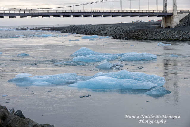
You can walk down to the lagoon and walk along the water's edge to the bridge. When you pass under the bridge you reach Diamond Beach.
But not before seeing some HUGE floating icebergs.
Diamond Beach
I first heard about Diamond Beach watching a Hallmark movie Love on Iceland. For me it wasn't as cool as the icebergs but some people really enjoyed being there.
More photos: CLICK HERE
We'll be having dinner and staying at the Hotel Framtíð
After dinner we check the skies-still too cloudy for Northern Lights-darn it!
Tomorrow we visit the East Fjords and head to Lake Mývatn


